The UCSB West (Left) Bank Archaeological Survey from el
Kab to Mograt
The University of California, Santa Barbara (UCSB) expedition began work at the fourth cataract with a reconnaissance survey on the right bank of the Nile from el Kab to the end of Mograt Island in November and December 2003. This salvage work was undertaken in co-ordination with the Meroe Dam Archaeological Salvage Project in areas that will be impacted by the new reservoire behind the Merowe Dam. That reservoire is now quickly filling with the completion of the dam (Summer 2008)
Our team consisted of Stuart Tyson Smith, George Herbst,
Michele Buzon, and Brian Park. Hassan Mohamed Ahmed, our representative
from the NCAM, ably assisted us.
The project was primarily supported by a grant from the National Science Foundation (BCS-0341789), with additional resources provided by UCSB.
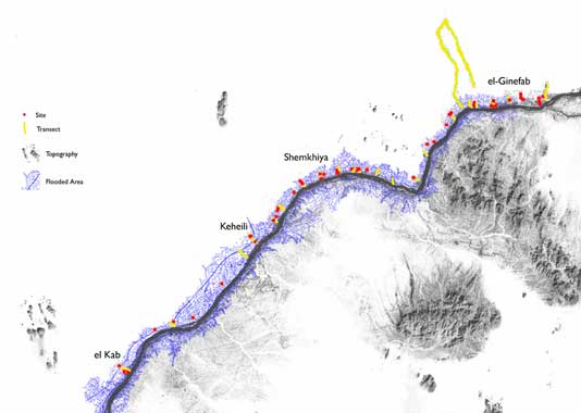
The entire area of the concession was covered and fifty-one
sites were registered. As part of our goals, we wanted to
produce a digital map of the archaeological sites that we
identified in the area between El Kab and Mograt. We were
initially limited by the fact that current topographic maps
of our study area were unavailable to us. To overcome this,
we relied on the integration of satellite imagery and Global
Positioning Systems data in a Geographic Information System-in
this case ArcView GIS. We recorded a total of 51 sites. Neolithic
and Kerma sites dominate the temporal inventory, accounting
for 60% of the sites that could be dated. Meroitic sites were
completely absent, and we could identify only a single Post-Meroitic
cemetery, although it is likely that some of the undated tumulus
cemeteries can be placed this period. Surprisingly, comparatively
few Christian and Islamic sites were identified, indicating
that the area was more sparsely occupied than the region further
downstream, in spite of the existence of saqqia technology
that would allow irrigation past the limited floodplain. This
may reflect the high riverbanks, rugged terrain and large
sand dunes that characterize this reach and continue to limit
settlement.
UCSB-ASU Joint Excavations
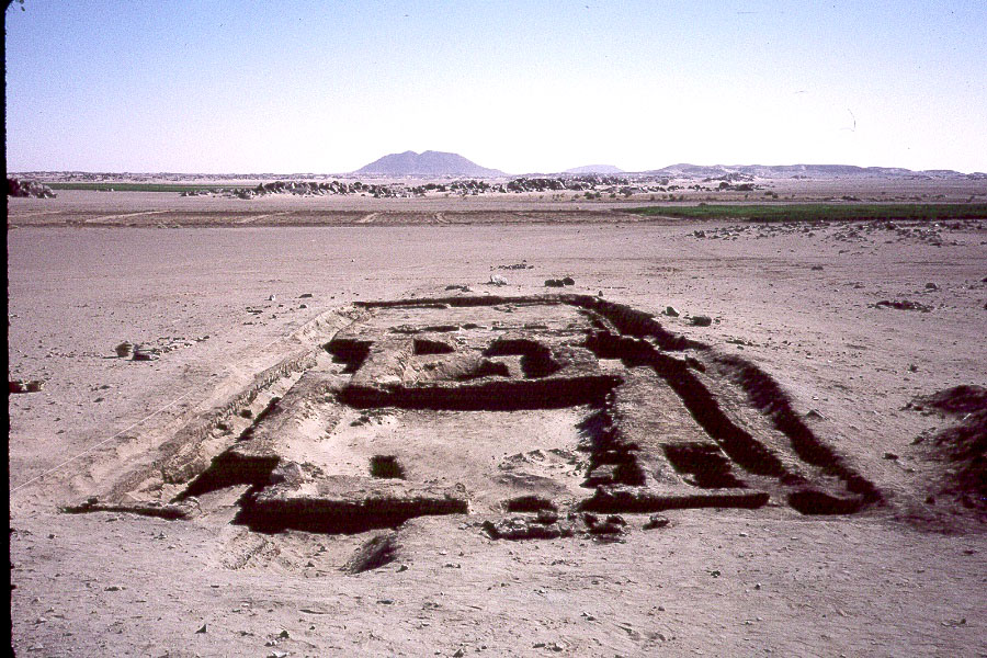
From 2006 to 2009, this salvage work entered its excavation phase as a collaborative project between UCSB and Arizona State University, directed by Stuart Tyson Smith, George Herbst (UCSB), and Brenda Baker (ASU). This work is supported by grants from the National Science Foundation, the Packard Humanities Institute, the UCSB Academic Senate and the Institute for Social, Behavioral and Economic Research at UCSB (ISBER). Results include the discovery of the only settlement sites in the region from the Neolithic and Kerma periods to have stratigraphy and remains of postholes and intact hearths indicating round houses, and the excavation of a large cemetery that includes an important transition from the late Meroitic period, through the Post-Meroitic, and on into the Christian era. ASU is following up in Winter 2009 with a final season of excavation.
Photo Album
UCSB Fourth Cataract Survey
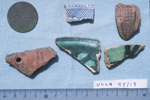
From the Dongola Reach survey: Egyptian 5 piaster coin, Islamic glazed ware, and European transfer print ceramic