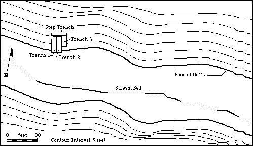
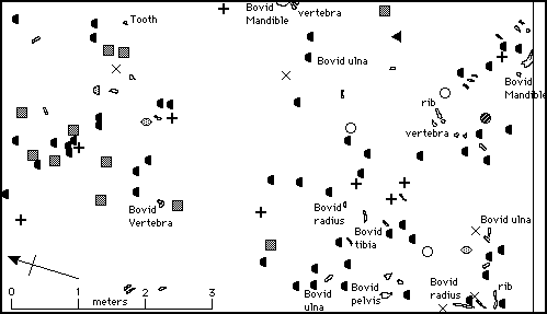
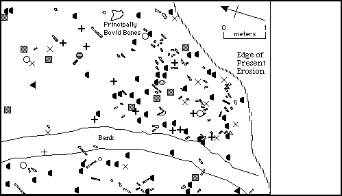
These are large scale plan drawings of the area of Site HWK East at Olduvai Gorge. The HWK East gully originates at the saddle between the two pinnacles HWK Castle and HWK Tower, runs easterly for 1/4 mile, and then turns sharply north to drain into the Main Gorge. Although identified as a site containing stone tools in 1931, intensive excavation of the site did not occur until 1962. At that time three adjacent, parallel trenches, about 15 feet wide, were excavated into the north wall of the gully. These trenches, numbered 1-3, cut through strata assigned to upper Bed I and the lower member of Bed II, thus providing valuable information on the transition from Bed I to Bed II times. Five distinct stratigraphic levels were detected. Level 1, the lowest level contained an extensive hominid occupation floor containing faunal remains and stone tools. Level 2 also contained an occupation floor with tools, but appears to be both later in time, and somewhat different in terms of artifactual content from Level 1. Levels 3-5 are stratigraphically sealed from the two levels below, and contain artifacts more similar to each other than to Level 2. You can navigate to additional information about this site by choosing a location from the "Go To:" pop-up menu below. You can also use the pop-up to return to the Master Map to look for more sites.
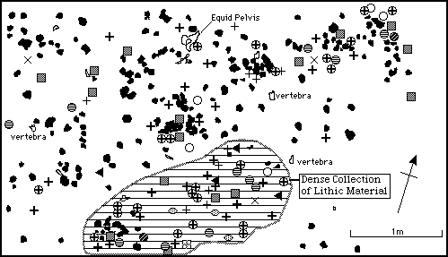
Trench 1, Level 2 Top
Trench 1, Level 2 Bottom
Trench 1, Level 1
Trench 2, Level 3
Note Different Scale and Orientation.
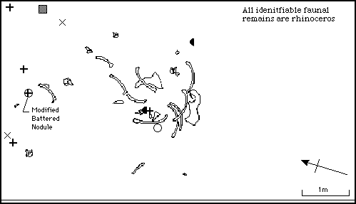
Trench 2, Level 1, North
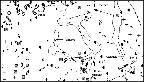
Trench 2, Level 1, South
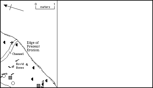
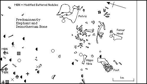
Trench 3, Level 1
Plan Map - HWK East Site Model